
A field of study for geography.
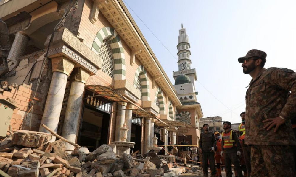
The Environmental–Social Nexus of Subnational Conflict in Pakistan
Key Words: Environment • Climate • Social • Conflict • Pakistan • Political Geography
The study, published in Weather, Climate, and Society and authored by David Leydet and researchers from the University of Utah, examines the environmental and social drivers of district-level conflict across Pakistan between 2010 and 2022. Utilizing self-organizing maps and random forest models across 160 districts alongside a targeted comparison of East Karachi, Lahore, Peshawar, and Quetta, the research identifies population density, urbanization, economic standing, and above-average spring temperatures as key predictors of localized violence. Counter to conventional expectations that conflict concentrates in poorer regions, the findings demonstrate that wealthier and more urbanized districts experience higher per capita rates of conflict, particularly violent incidents. Ultimately, this exploratory framework highlights how climate variables interact with socio-economic conditions at subnational scales, offering insights for region-specific peacebuilding and risk-assessment strategies.
Want to know more? Click here to read the full paper!

When vulnerability does not predict mortality: The uses and limits of heat vulnerability indices
Key Words: Heat vulnerability index • Heat-related excess mortality • Extreme heat • Heat waves • Urban climate risk • Spatiotemporal analysis
The study, published in Environmental Research and co-authored by faculty member Elizabeth Dzwonczyk, evaluates the long-term validity of Heat Vulnerability Indices (HVIs) by examining a 30-year, census-tract-level dataset of Denver, Colorado, from 1990 to 2019 to test whether neighborhoods identified as highly vulnerable match those experiencing the highest heat-related excess mortality. Utilizing multiple validation frameworks—including statistical association, classification performance, and spatial correspondence—researchers compared HVI scores against observed and modeled mortality across both moderate and extreme heat waves. The findings revealed that alignment between spatial vulnerability and actual mortality is weak, inconsistent, and highly dependent on heat intensity and the specific decade, with high-vulnerability neighborhoods rarely overlapping with peak mortality areas during extreme heat events. Rather than invalidating vulnerability indexing, the authors emphasize a crucial distinction: static, place-based HVIs are effective for mapping baseline susceptibility and systemic inequity, but they should not be relied upon to predict event-specific spatial mortality. Ultimately, this distinction provides critical guidance for environmental health researchers and urban planners, offering a clearer framework for operationalizing HVIs in climate adaptation strategies.
Want to know more? Click here to read the full paper!

Weathering the ride: Associations of heat, smoke, precipitation, and ozone with bus ridership in Coloradoof temperature in Denver, Colorado
Key Words: Heat • Precipitation • Wildfire smoke • Bus ridership • Free fare policies • Front range
The study, published in Environmental Research and co-authored by faculty member Elizabeth Dzwonczyk, analyzes system-wide hourly bus ridership in the Denver metropolitan area from June 2022 through September 2023 to evaluate how short-term weather variability and air quality events shape public transit behavior. Utilizing fixed-effects negative binomial distributed lag nonlinear models, researchers modeled the immediate and delayed impacts of temperature stress, precipitation, ozone exceedances, and wildfire smoke while accounting for contextual modifiers like fare policy and shelter availability. The findings revealed that cold thermal stress caused the largest and most persistent cumulative drops in ridership, whereas precipitation prompted sharp but short-lived reductions concentrated within a few hours. While ambient air quality events like wildfire smoke showed limited impact overall, zero-fare policies and stop-level shelter infrastructure significantly modified weather-related ridership declines. Ultimately, this research provides transit agencies with actionable strategies to enhance public transportation resilience and maintain reliable service under increasing climate variability.
Want to know more? Click here to read the full paper!

Heat and mortality in a semi-arid city: A multi-scalar analysis of the impacts of temperature in Denver, Colorado
Key Words: Extreme heat • Temperature-mortality relationships • Heat wave effect • Generalized additive model • Mortality
The study, published in Urban Climate and authored by Elizabeth Dzwonczyk and researchers from the University of Colorado Denver, investigates the temperature-mortality relationship in a semi-arid urban environment over a 30-year period. Utilizing generalized additive models across citywide, census tract, and block group scales, the research demonstrates that 5-day rolling averages of daily maximum surface air temperature offer the most robust predictor of heat-related mortality. These findings identify a modest but consistent heat wave effect and provide localized predictive maps that show risk patterns diverging from conventional socioeconomic vulnerability indicators. Ultimately, this multi-scalar framework offers a replicable approach for other semi-arid metropolitan areas to design targeted, equity-driven public health interventions and neighborhood-level adaptation strategies.
Want to know more? Click here to read the full paper!
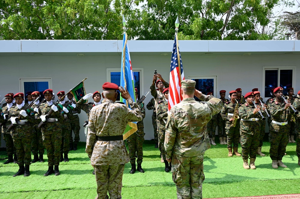
Network-centric US military intelligence strategy for Africa’s evolving geopolitical landscape
Key Words: Military intelligence • Africa • United States • United States • network-centric
The study, published in the African Security Review and co-authored by West Point geography faculty member John Melkon, examines the growing geopolitical competition in Africa, specifically focusing on expanding Chinese influence. The authors advocate for a network-centric approach to U.S. Military Intelligence (USMI), emphasizing the critical integration of human intelligence (HUMINT) and the establishment of strategic partnerships with African intelligence services. By applying social network theory, the research outlines strategies to engage key influential nodes within these local communities, which maximizes information flow and counters adversarial disinformation. These findings highlight the necessity of joint intelligence centers, staff exchanges, and revitalized regional expertise, expanding the U.S. framework for maintaining strategic partnerships and regional stability in an era of great power competition.
To cite this article: John Melkon, Brock A. Salgado & Dries Putter (03 Aug 2025): Network-centric US military intelligence strategy for Africa’s evolving geopolitical landscape, African Security Review, DOI: 10.1080/10246029.2025.2528706
Want to know more? Click here to read the full paper!
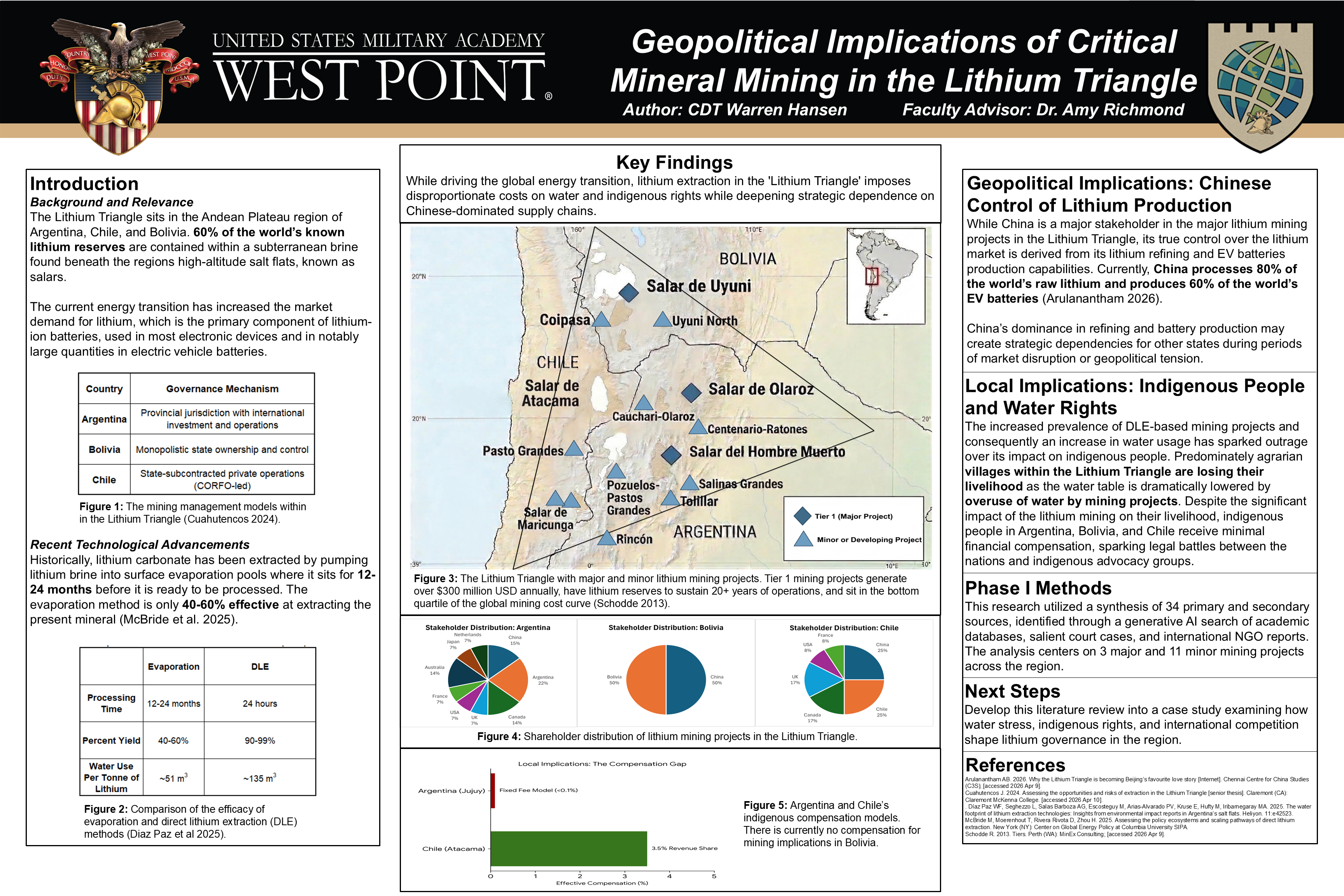
Geopolitical Implications of Critical Mineral Mining in the Lithium Triangle
Introduction
Background and Relevance
The Lithium Triangle sits in the Andean Plateau region of Argentina, Chile, and Bolivia. 60% of the world’s known lithium reserves are contained within a subterranean brine found beneath the regions high-altitude salt flats, known as salars.
The current energy transition has increased the market demand for lithium, which is the primary component of lithium-ion batteries, used in most electronic devices and in notably large quantities in electric vehicle batteries.