

The Environmental–Social Nexus of Subnational Conflict in Pakistan
Key Words: Environment • Climate • Social • Conflict • Pakistan • Political Geography
The study, published in Weather, Climate, and Society and authored by David Leydet and researchers from the University of Utah, examines the environmental and social drivers of district-level conflict across Pakistan between 2010 and 2022. Utilizing self-organizing maps and random forest models across 160 districts alongside a targeted comparison of East Karachi, Lahore, Peshawar, and Quetta, the research identifies population density, urbanization, economic standing, and above-average spring temperatures as key predictors of localized violence. Counter to conventional expectations that conflict concentrates in poorer regions, the findings demonstrate that wealthier and more urbanized districts experience higher per capita rates of conflict, particularly violent incidents. Ultimately, this exploratory framework highlights how climate variables interact with socio-economic conditions at subnational scales, offering insights for region-specific peacebuilding and risk-assessment strategies.
Want to know more? Click here to read the full paper!

Field Note: A Tale of Two Boundaries
Seven Cadets from each of the three GEO majors circumnavigated Iceland during an Academic Individual Advanced Development (AIAD) experience this summer with LTC Joel Radunzel and LTC Lauren Koban. Their mission was to answer the question, “Where are Iceland’s physical and human elements interconnected, and how do these connections illustrate global relationships between people and the planet?”
Click here to learn more about AIADs in the Department of Geography and Earth Sciences!

When vulnerability does not predict mortality: The uses and limits of heat vulnerability indices
Key Words: Heat vulnerability index • Heat-related excess mortality • Extreme heat • Heat waves • Urban climate risk • Spatiotemporal analysis
The study, published in Environmental Research and co-authored by faculty member Elizabeth Dzwonczyk, evaluates the long-term validity of Heat Vulnerability Indices (HVIs) by examining a 30-year, census-tract-level dataset of Denver, Colorado, from 1990 to 2019 to test whether neighborhoods identified as highly vulnerable match those experiencing the highest heat-related excess mortality. Utilizing multiple validation frameworks—including statistical association, classification performance, and spatial correspondence—researchers compared HVI scores against observed and modeled mortality across both moderate and extreme heat waves. The findings revealed that alignment between spatial vulnerability and actual mortality is weak, inconsistent, and highly dependent on heat intensity and the specific decade, with high-vulnerability neighborhoods rarely overlapping with peak mortality areas during extreme heat events. Rather than invalidating vulnerability indexing, the authors emphasize a crucial distinction: static, place-based HVIs are effective for mapping baseline susceptibility and systemic inequity, but they should not be relied upon to predict event-specific spatial mortality. Ultimately, this distinction provides critical guidance for environmental health researchers and urban planners, offering a clearer framework for operationalizing HVIs in climate adaptation strategies.
Want to know more? Click here to read the full paper!

Weathering the ride: Associations of heat, smoke, precipitation, and ozone with bus ridership in Coloradoof temperature in Denver, Colorado
Key Words: Heat • Precipitation • Wildfire smoke • Bus ridership • Free fare policies • Front range
The study, published in Environmental Research and co-authored by faculty member Elizabeth Dzwonczyk, analyzes system-wide hourly bus ridership in the Denver metropolitan area from June 2022 through September 2023 to evaluate how short-term weather variability and air quality events shape public transit behavior. Utilizing fixed-effects negative binomial distributed lag nonlinear models, researchers modeled the immediate and delayed impacts of temperature stress, precipitation, ozone exceedances, and wildfire smoke while accounting for contextual modifiers like fare policy and shelter availability. The findings revealed that cold thermal stress caused the largest and most persistent cumulative drops in ridership, whereas precipitation prompted sharp but short-lived reductions concentrated within a few hours. While ambient air quality events like wildfire smoke showed limited impact overall, zero-fare policies and stop-level shelter infrastructure significantly modified weather-related ridership declines. Ultimately, this research provides transit agencies with actionable strategies to enhance public transportation resilience and maintain reliable service under increasing climate variability.
Want to know more? Click here to read the full paper!
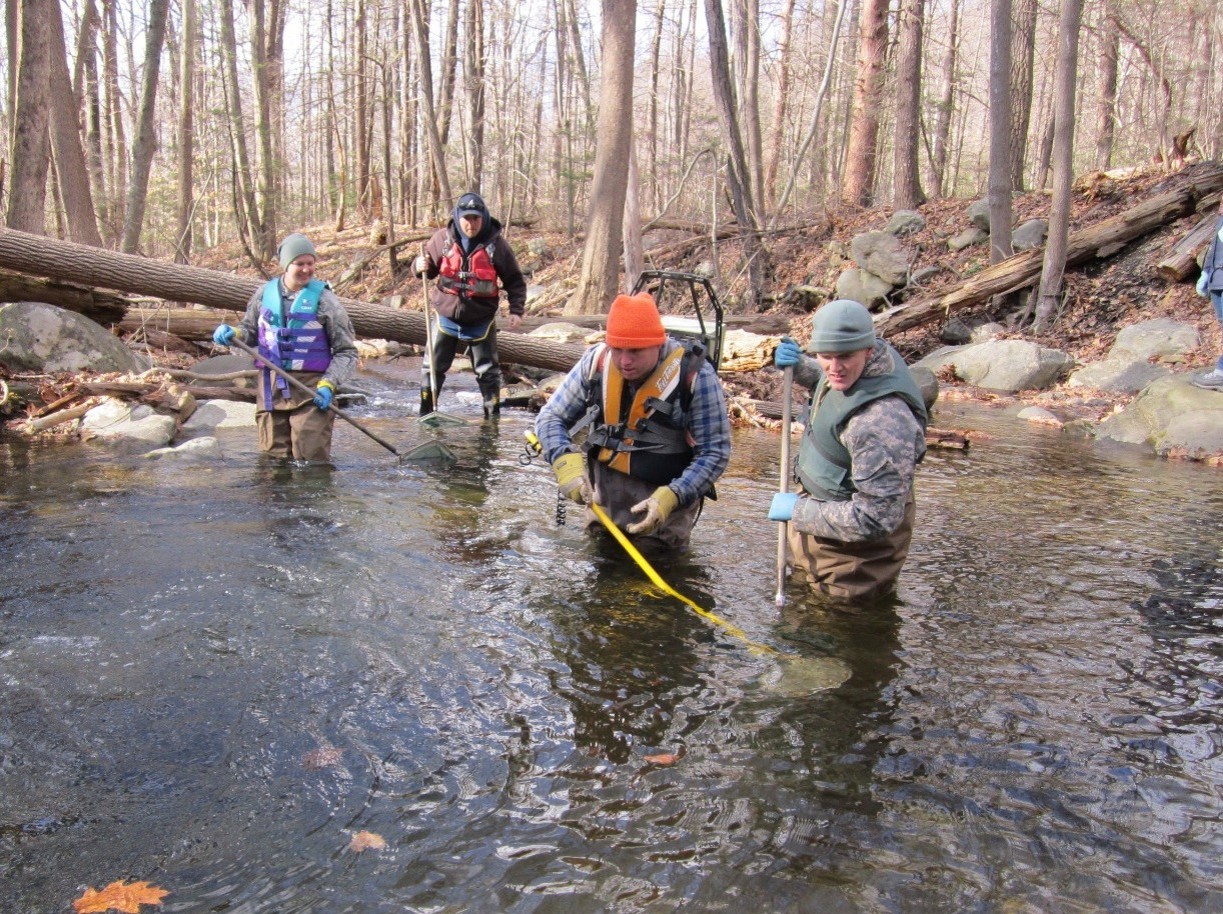
Fish size and assemblage patterns following dam failure in Black Rock Brook New York
Key Words: dam removal • fish assemblages • species diversity • stream ecology • morphometrics • ecological monitoring
The study, published in Journal of Freshwater Ecology and authored by Environmental Science faculty member CPT Alaina McLaughlin and a fellow 2017 West Point classmate, builds on research the two authors conducted together as cadets investigating fish populations in Black Rock Brook, New York. After a hurricane caused the Cornwall Lower Reservoir dam to fail in 2011, the authors were able to compare fish data collected before the failure in 2010 with surveys of the same stream reaches conducted in 2017. The post-failure survey documented significantly smaller blacknose dace and lower observed fish species richness and diversity both above and below the former dam, demonstrating that ecological responses to barrier loss can extend throughout a stream and vary among species. The findings highlight the importance of long-term ecological monitoring while demonstrating how baseline data collected through cadet research can provide lasting value for understanding environmental change and guiding future management decisions.
To cite this article: McLaughlin A. & McConnell, H. (2026). Fish size and assemblage patterns following dam failure in Black Rock Brook, New York, Journal of Freshwater Ecology, 41:1, 2703163, DOI: https://doi.org/10.1080/02705060.2026.2703163
Want to know more? Click here to read the full paper!

A matrix approach to visually communicate simultaneously the environmental and health impacts of foods
Key Words: environmental sustainability • human health • food groups • relative risk • health index
The study, published in Frontiers in Nutrition and co-authored by West Point faculty member Andrew Berardy, introduces a visual matrix designed to simultaneously communicate the environmental and health impacts of 30 commonly consumed food groups in the United States. Researchers aggregated data on carbon footprints and relative disease risks to categorize foods, demonstrating that plant-based, less-processed options generally offer favorable health benefits and lower carbon footprints compared to animal-based and highly processed alternatives. By intuitively highlighting the tradeoffs of various dietary choices, this matrix provides a practical tool for quickly evaluating sustainability and health outcomes. Ultimately, this accessible framework encourages more informed decision-making among consumers, policymakers, and health professionals to improve both human and planetary health.
To cite this article: Berardy, A., Fresán, U., Abbaspour, N., & Sabaté, J. (2025). A matrix approach to visually communicate simultaneously the environmental and health impacts of foods. Frontiers in Nutrition (Lausanne), 12, 1572297. https://doi.org/10.3389/fnut.2025.1572297
Want to know more? Click here to read the full paper!
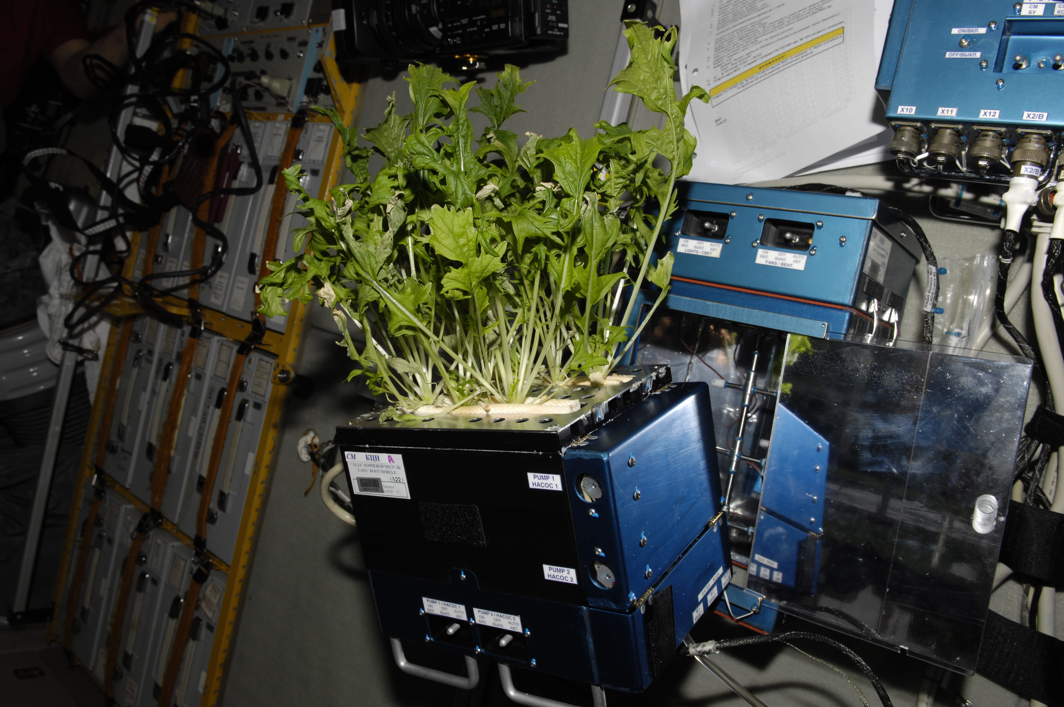
Design and ground testing of a Zero-Discharge plant growth system for microgravity Applications
Key Words: Microgravity • Space agriculture • Automated fertigation • Re-planting • Water Use Efficiency • Mizuna • Moisture sensors
The study, published in Computers and Electronics in Agriculture and co-authored by West Point faculty member Sarah Schreck, details the design and ground testing of the Utah Reusable Root Module (URRM) system developed for space-based agriculture within NASA’s Ohalo III Crop Production System. Researchers engineered a zero-discharge, automated fertigation framework equipped with redundant soil moisture sensors and innovative top cover containment designs to manage water, nutrients, and gas distribution in a microgravity environment. Preliminary ground tests utilizing Mizuna demonstrated that the system reliably maintained target soil moisture ranges and uniform resource distribution without manual intervention, successfully yielding over 1 kg of fresh edible biomass. These findings highlight the URRM’s capacity to support semi-autonomous, high-efficiency crop production across continuous cycles, significantly strengthening the feasibility of life-support systems for long-duration human space exploration.
To cite this article: Garrido-Ruiz, C., González-Teruel, J. D., Dixon, C., Schreck, S., Bingham, C., Winward, T., Hutchings, R., Bingham, G. E., Bugbee, B., & Jones, S. B. (2025). Design and ground testing of a Zero-Discharge plant growth system for microgravity Applications. Computers and Electronics in Agriculture, 239, Article 111044. https://doi.org/10.3354/esr01429
Want to know more? Click here to read the full paper!

Heat and mortality in a semi-arid city: A multi-scalar analysis of the impacts of temperature in Denver, Colorado
Key Words: Extreme heat • Temperature-mortality relationships • Heat wave effect • Generalized additive model • Mortality
The study, published in Urban Climate and authored by Elizabeth Dzwonczyk and researchers from the University of Colorado Denver, investigates the temperature-mortality relationship in a semi-arid urban environment over a 30-year period. Utilizing generalized additive models across citywide, census tract, and block group scales, the research demonstrates that 5-day rolling averages of daily maximum surface air temperature offer the most robust predictor of heat-related mortality. These findings identify a modest but consistent heat wave effect and provide localized predictive maps that show risk patterns diverging from conventional socioeconomic vulnerability indicators. Ultimately, this multi-scalar framework offers a replicable approach for other semi-arid metropolitan areas to design targeted, equity-driven public health interventions and neighborhood-level adaptation strategies.
Want to know more? Click here to read the full paper!
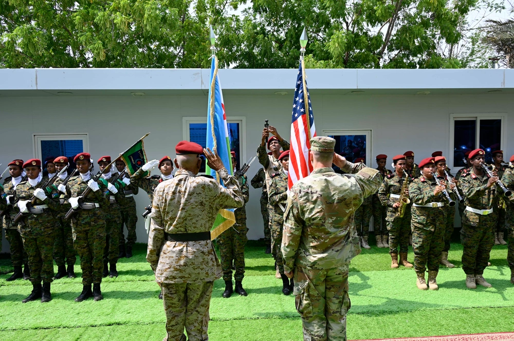
Network-centric US military intelligence strategy for Africa’s evolving geopolitical landscape
Key Words: Military intelligence • Africa • United States • United States • network-centric
The study, published in the African Security Review and co-authored by West Point geography faculty member John Melkon, examines the growing geopolitical competition in Africa, specifically focusing on expanding Chinese influence. The authors advocate for a network-centric approach to U.S. Military Intelligence (USMI), emphasizing the critical integration of human intelligence (HUMINT) and the establishment of strategic partnerships with African intelligence services. By applying social network theory, the research outlines strategies to engage key influential nodes within these local communities, which maximizes information flow and counters adversarial disinformation. These findings highlight the necessity of joint intelligence centers, staff exchanges, and revitalized regional expertise, expanding the U.S. framework for maintaining strategic partnerships and regional stability in an era of great power competition.
To cite this article: John Melkon, Brock A. Salgado & Dries Putter (03 Aug 2025): Network-centric US military intelligence strategy for Africa’s evolving geopolitical landscape, African Security Review, DOI: 10.1080/10246029.2025.2528706
Want to know more? Click here to read the full paper!

Sounds of Atlantic sturgeon spawning: first description and opportunities for riverine endangered species conservation with passive acoustic monitoring
Key Words: Bioacoustics • Anadromous fish • Spawning aggregation • Fisheries management • Acipenser oxyrinchus
The study, published in Endangered Species Research and co‑authored by Environmental Science Program faculty member Dr. Patrick Baker, provides the first confirmed description of Atlantic sturgeon (Acipenser oxyrinchus) spawning sounds in the Hudson River. Researchers identified a distinctive 44 Hz low‑frequency signal that reliably aligned with telemetry‑tagged adults during spawning periods, with captive recordings validating the same acoustic cue. These findings highlight passive acoustic monitoring as a powerful, non‑invasive tool for detecting spawning aggregations, tracking habitat use, and improving conservation strategies for this endangered species. By establishing a new biological indicator, the study expands the role of bioacoustics in freshwater fisheries management and endangered species recovery.
To cite this article: Cohen R, Baker PJ, Bowser C, Breece MW, Flecker A, Fox D, Henne J, Higgs A, Niemistö M, Pendleton R, Sethi SA, White SL, Rice A. 2025. Sounds of Atlantic sturgeon spawning: first description and opportunities for riverine endangered species conservation with passive acoustic monitoring. Endanger Species Res. 14(2):127–135. https://doi.org/10.3354/esr01429
Want to know more? Click here to read the full paper!
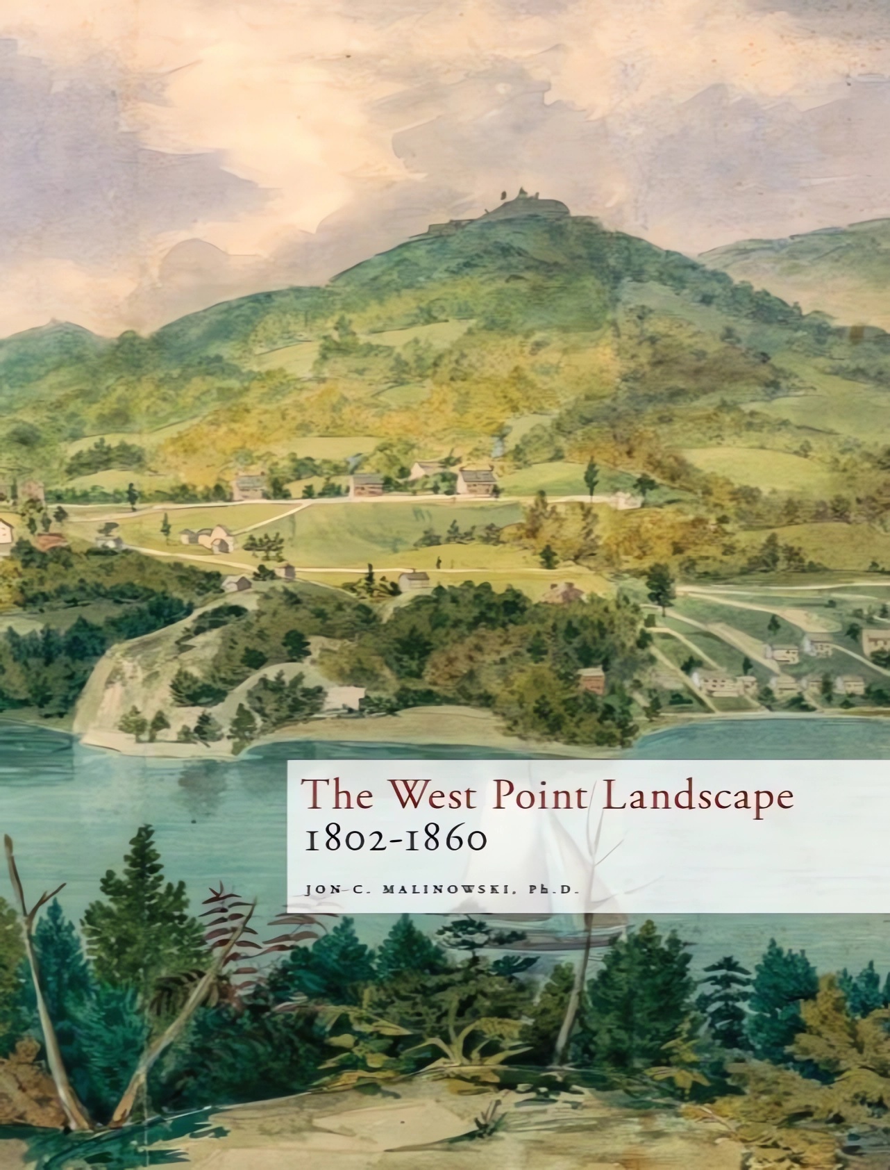
The West Point Landscape: 1802-1860
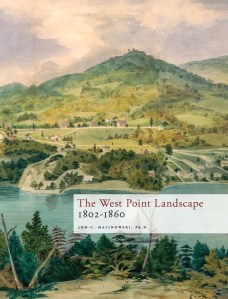 Through the use of maps and historical graphics, readers gain a better understanding of some of the rich, early history of West Point. Extensively researched but presented in an accessible way, this heavily illustrated work chronicles the landscape history of the United States Military Academy from 1802 to 1860.

Sylvanus Thayer: A Biography
 This updated biography of Sylvanus Thayer provides a chronological look at the life of the man best known as the “Father of the United States Military Academy.” Jon C. Malinowski’s additions to James William Kershner’s original work makes this the comprehensive biography on Thayer, putting him in proper historical context to show his importance as an engineer, educator, and leader in a formative era of American history.

Language, Regional Expertise, and Culture in the Military
 In today’s complex global security environment, military effectiveness depends not only on advanced technology and tactics but also on the ability to understand, communicate, and collaborate across cultures. This interdisciplinary volume examines the evolving role of language, regional expertise, and cultural competency (LREC) in U.S. military training, strategy, and leadership. Drawing on insights from both military and academic contributors, this collection offers a timely and authoritative overview of how LREC competencies support deterrence, interoperability, influence operations, and alliance-building for the warfighter.
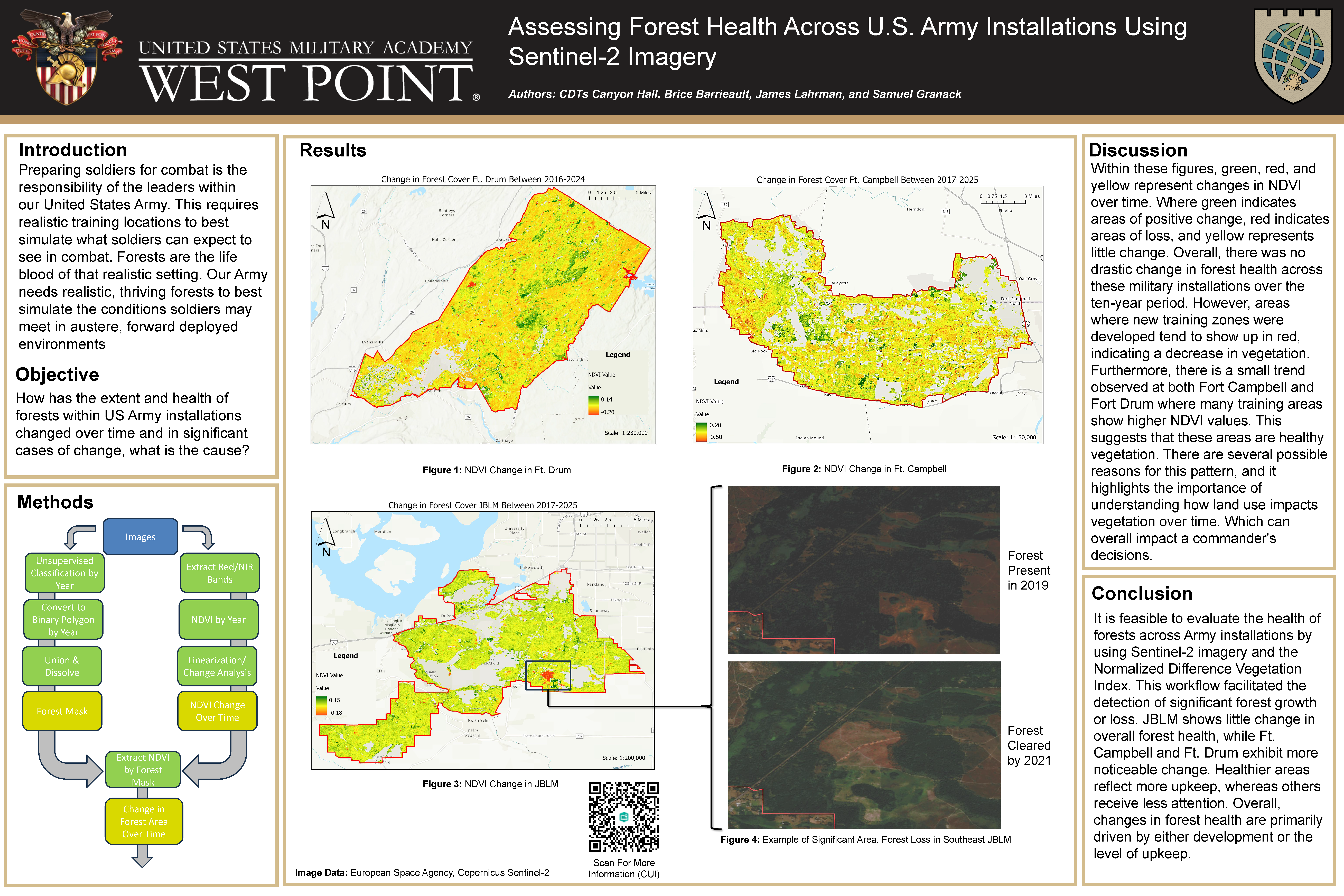
Assessing Forest Health Across U.S. Army Installations Using Sentinel-2 Imagery
Introduction
Preparing soldiers for combat is the responsibility of the leaders within our United States Army. This requires realistic training locations to best simulate what soldiers can expect to see in combat. Forests are the life blood of that realistic setting. Our Army needs realistic, thriving forests to best simulate the conditions soldiers may meet in austere, forward deployed environments
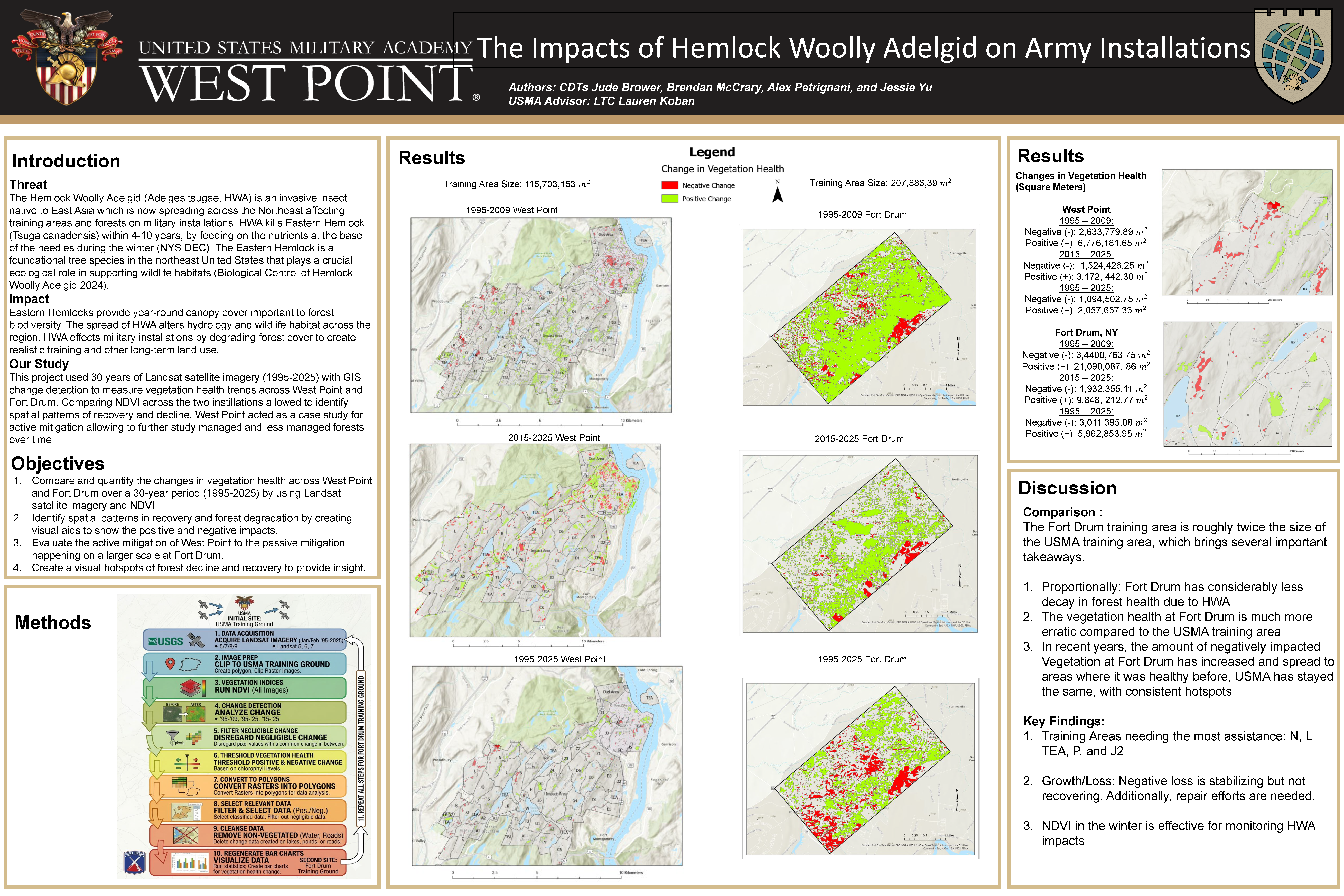
The Impacts of Hemlock Woolly Adelgid on Army Installations
Introduction
Threat
The Hemlock Woolly Adelgid (Adelges tsugae, HWA) is an invasive insect native to East Asia which is now spreading across the Northeast affecting training areas and forests on military installations. HWA kills Eastern Hemlock (Tsuga canadensis) within 4-10 years, by feeding on the nutrients at the base of the needles during the winter (NYS DEC). The Eastern Hemlock is a foundational tree species in the northeast United States that plays a crucial ecological role in supporting wildlife habitats (Biological Control of Hemlock Woolly Adelgid 2024)
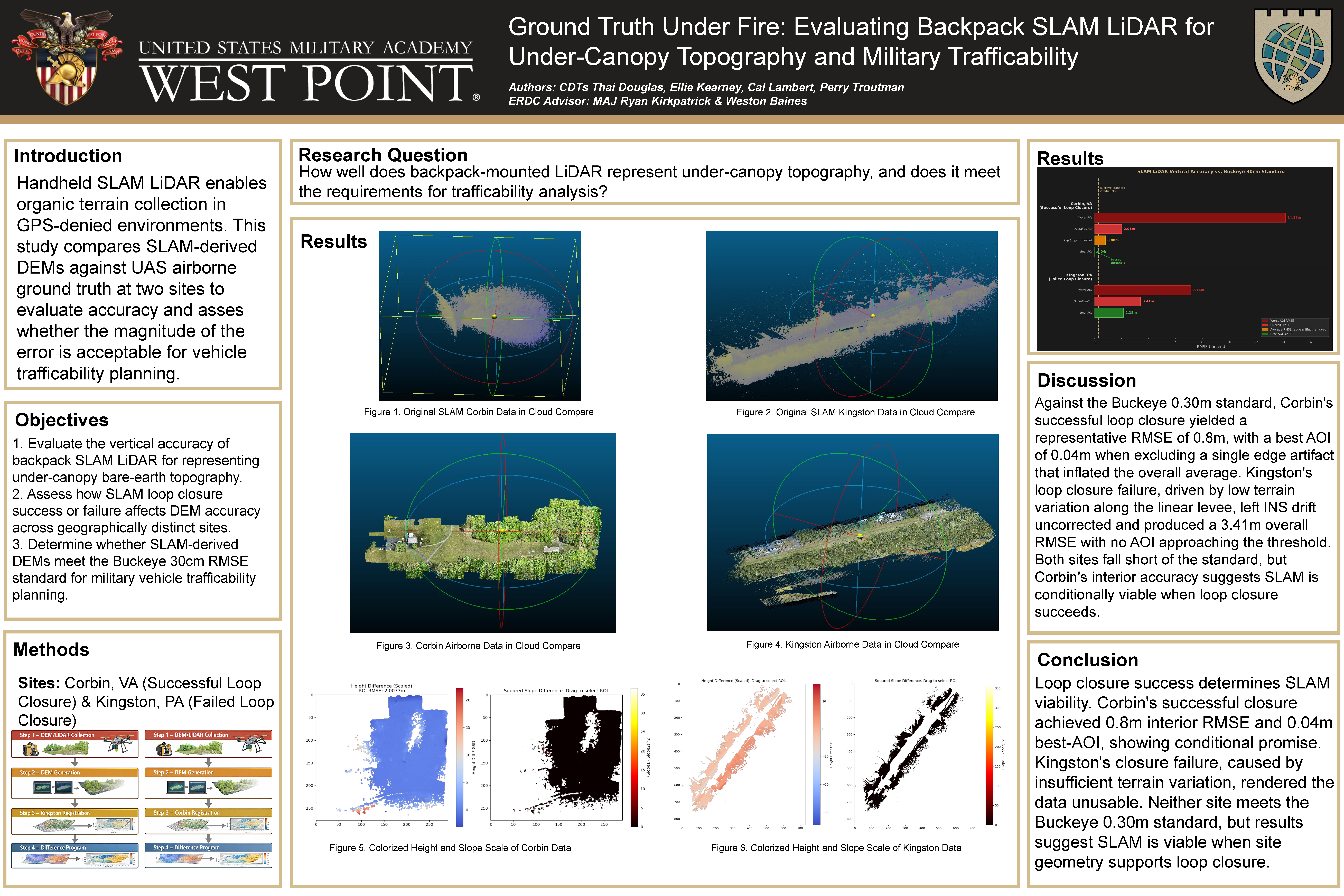
Ground Truth Under Fire: Evaluating Backpack SLAM LiDAR for Under-Canopy Topography and Military Trafficability
Handheld SLAM LiDAR enables organic terrain collection in GPS-denied environments. This study compares SLAM-derived DEMs against UAS airborne ground truth at two sites to evaluate accuracy and asses whether the magnitude of the error is acceptable for vehicle trafficability planning.
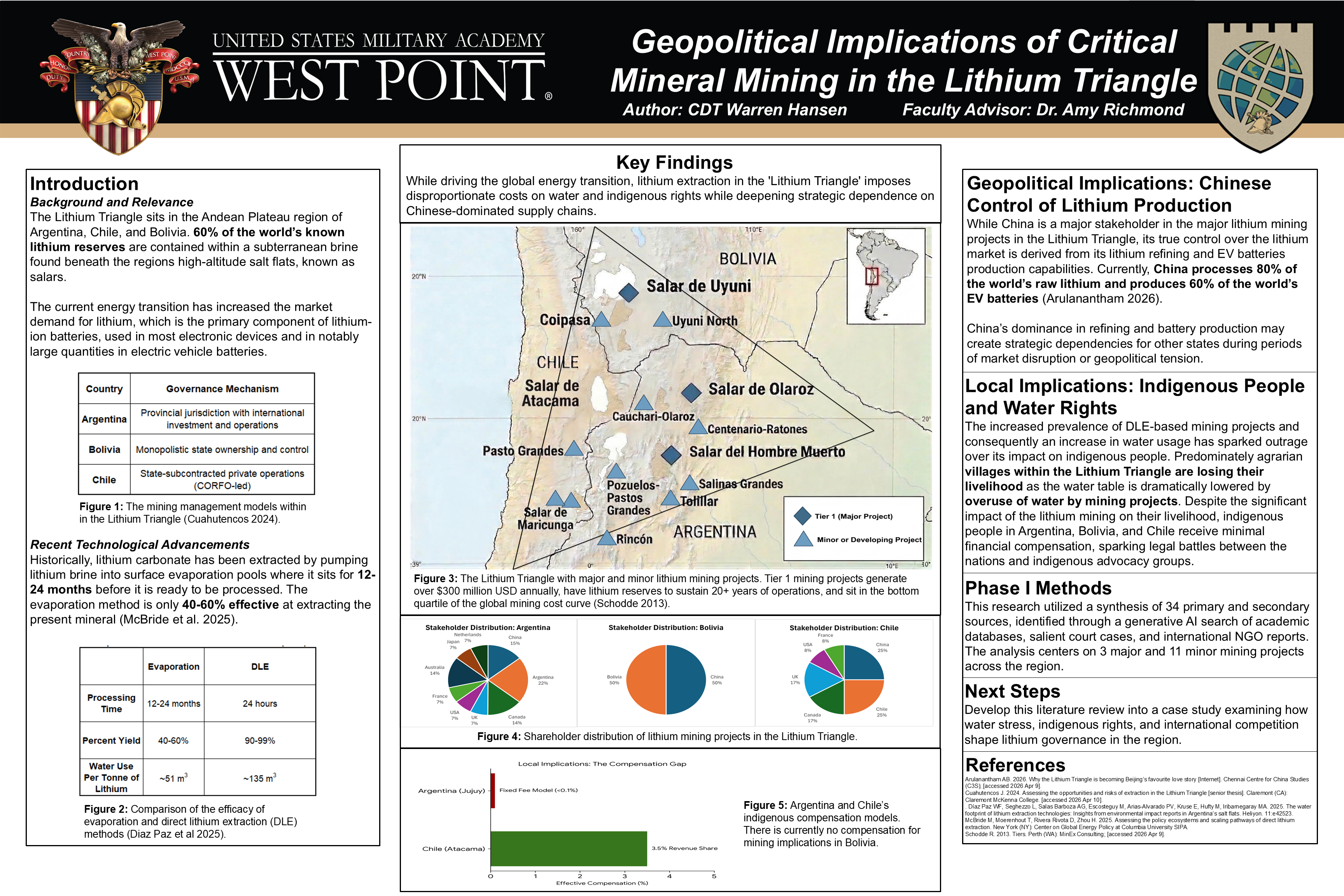
Geopolitical Implications of Critical Mineral Mining in the Lithium Triangle
Introduction
Background and Relevance
The Lithium Triangle sits in the Andean Plateau region of Argentina, Chile, and Bolivia. 60% of the world’s known lithium reserves are contained within a subterranean brine found beneath the regions high-altitude salt flats, known as salars.
The current energy transition has increased the market demand for lithium, which is the primary component of lithium-ion batteries, used in most electronic devices and in notably large quantities in electric vehicle batteries.